The headwaters of the Gila River begin on the western slope of the continental divide. The West fork of the Gila flows southeast near the Gila Cliff Dwellings, once inhabited by the Mogollon culture between (600-1400 AD). The confluence of the Gila river forms slightly south of the Gila Cliff Dwellings where the West, Middle, and East Fork join into the Gila Wilderness which is only accesible by unpaved road that ends near Brock Canyon Ravine. Wilderness camp locations along the river are available to the few who know of their existence. The pristine environment is untouched by the economic influences that drive the land-use south of Gila, and is fiercely protected by environmental and community interests.
In 1968, Congress enacted the Wild and Scenic Rivers Act (WSRA) to designate selected rivers to be “preserved in free-flowing condition, and that they and their immediate environments shall be protected for the benefit and enjoyment of present and future generations.” Free-flowing rivers are important because they recharge groundwater, remain vital for the survival and health of fish populations, bolster biodiversity by destroying or changing habitats and preventing migration, and transfer sediment to deltas or flood plains, which helps reduce flood and drought risks. Wild and Scenic River designation neither limits the public from accessing public lands nor opens private lands to public access. Designation does not change the existing water rights or irrigation systems. Fishing and hunting regulations will stay the same.
In November of 2021, New Mexico Senators Martin Heinrich and Ben Ray Lujan, re-introduced the M.H. Dutch Salmon Greater Gila Wild and Scenic Rivers Act, which would protect nearly 450 miles of the Gila and San Francisco Rivers and their tributaries under the Wild and Scenic Rivers Act. The bill sits with the Senate Committee on Energy and Natural Resources for consideration. As written, it protects existing, traditional uses of the river, it permanently maintains historical water rights, and it preserves the healthy, free-flowing nature of one of New Mexico’s last remaining wild rivers.
Access to the Gila River by car shifts to an unpaved road that ends near Brock Canyon Ravine. Wilderness camp locations along the river are available to the few who know of their existence. The pristine environment is untouched by the economic influences that drive the land-use south of Gila, and is fiercely protected by environmental and community interests.
In 2019 American Rivers listed the Gila River as the America’s Most Endangered River, citing the grave threat that climate change and a proposed diversion project pose to New Mexico’s last free-flowing river. The Gila River Diversion Project (supported by cattle growers, farm and livestock bureau, and a coalition of AZ/NM counties) was developed to enable 4 locations intended to divert water from the Gila River (14,000 acre/ft or 14 billion gal) for local agriculture and mining needs. The project was funded by the Colorado River Basin Project Act of 1968 and the Arizona Water Settlements Act of 2004, according to the Bureau of Reclamation.
That legislation allowed New Mexico to divert water from the Gila River and its tributaries in exchange for delivering an equivalent amount of water downstream to Arizona, giving the state access to up to $90 million in federal dollars for water projects.
In 2014, New Mexico chose to pursue a Gila River diversion with that money. Environmental groups and community leaders aggressively opposed any diversion projects that would source water to Arizona and threaten the wildlife and natural resources critical to the preservation of New Mexico’s last free flowing river. The Gila River was designated as the nations most endangered river in 2019, and its main threat: diversion (American Rivers national conservation group). This fierce debate essentially froze the millions of federal dollars pending the outcome of legislative action. In the spring of 2021, House bill 200 was signed into law, prohibiting diversion projects and assigning the remaining (approximately 80 million) federal dollars to a Water Trust Board that will designate funds with the goal “the fair distribution and allocation of New Mexico’s scarce water resources for beneficial purposes of use within the state.”
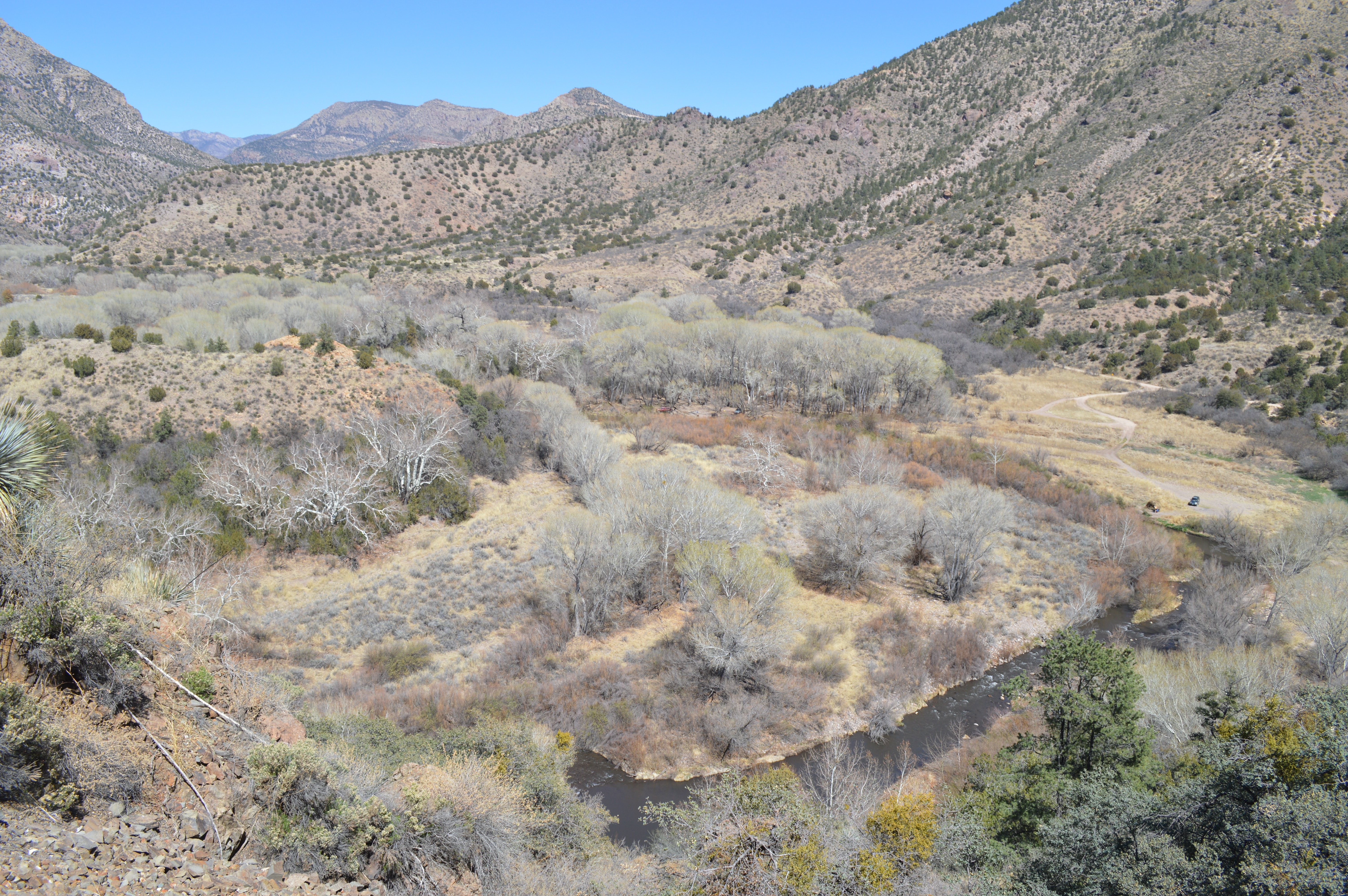
The road to Brock Canyon and entnry into the Gila Wilderness was a wide ride. Three adults and two large dogs, Allie and Roxanne, piled into Russ Smith's old Chevy Diesel 4 Wheel drive pick up truck. About 8 miles or so the gravel road turned to hard packed dirt with exposed rocks, divets, and ruts seemingly everywhere as we made our way slowly up the mountain grade. Russ provided an experienced ride, neither timid or too aggressive. We bounced and swerved along for quite some time arriving at an overlook from where we precariously stopped to take in the view after the Gila River disappears into Brock Canyon and the Gila Wilderness.
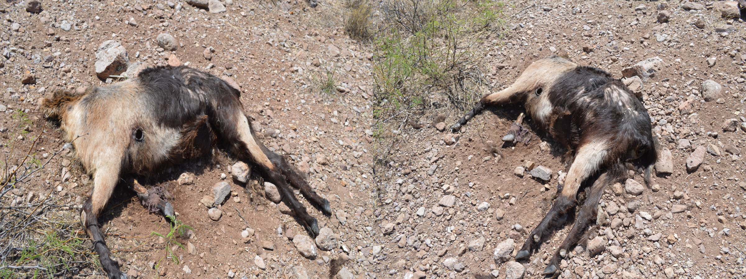
Protecting the iconic Gila River and its agricultural and recreational economies is not limited to how its water is resourced. In February of 2022, the US Forestry Service was tasked with removing feral cattle from the wilderness due to the decades long damage they caused; overgrazing the vegetation, eroding stream banks, and destroying natural habitat. According to the producers in the area, the Forest Service did not make the effort to gather the cattle, but rather contracted a sharp-shooter in a helicopter at the cost of $40,000 for 2 days who were instructed to shoot as many of the estimated 150 cattle as possible. The New Mexico Cattle Growers Association filed a complaint in federal district court to stop the aerial shooting, over concerns there would be wounded cattle, orphaned calves, unintended branded cattle slaughtered, and rotting carcasses left for wolves, bears, mountain lions, and the endangered Mexican wolf (predators that would develop a taste for beef). In addition to the inhumanity, the beef would be wasted. The court denied the restraining order.
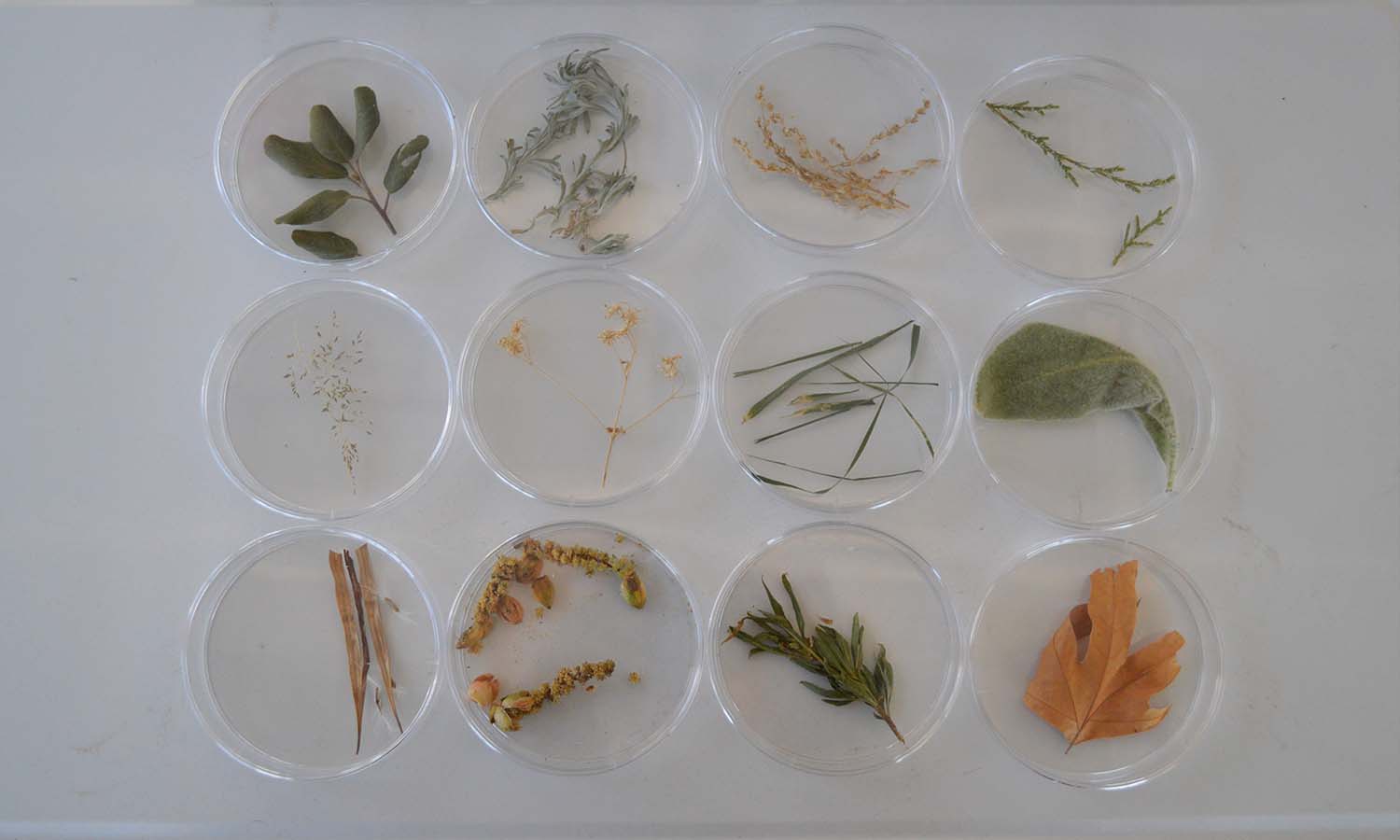
The gathering of samples involves the collection of the specimens, processing and sorting, documenting, and presentation. Organized collections of specimens serves to inform the overall ecology being examined and provide insight into the complexity of interacting systems. Samples from The Gila Wilderness near Brock Canyon includes Buckthorn Bush, Desert Willow, Mugwort, Cottonwood Flower, Crab Grass, Juniper, Mullen, AZ Sycamore.
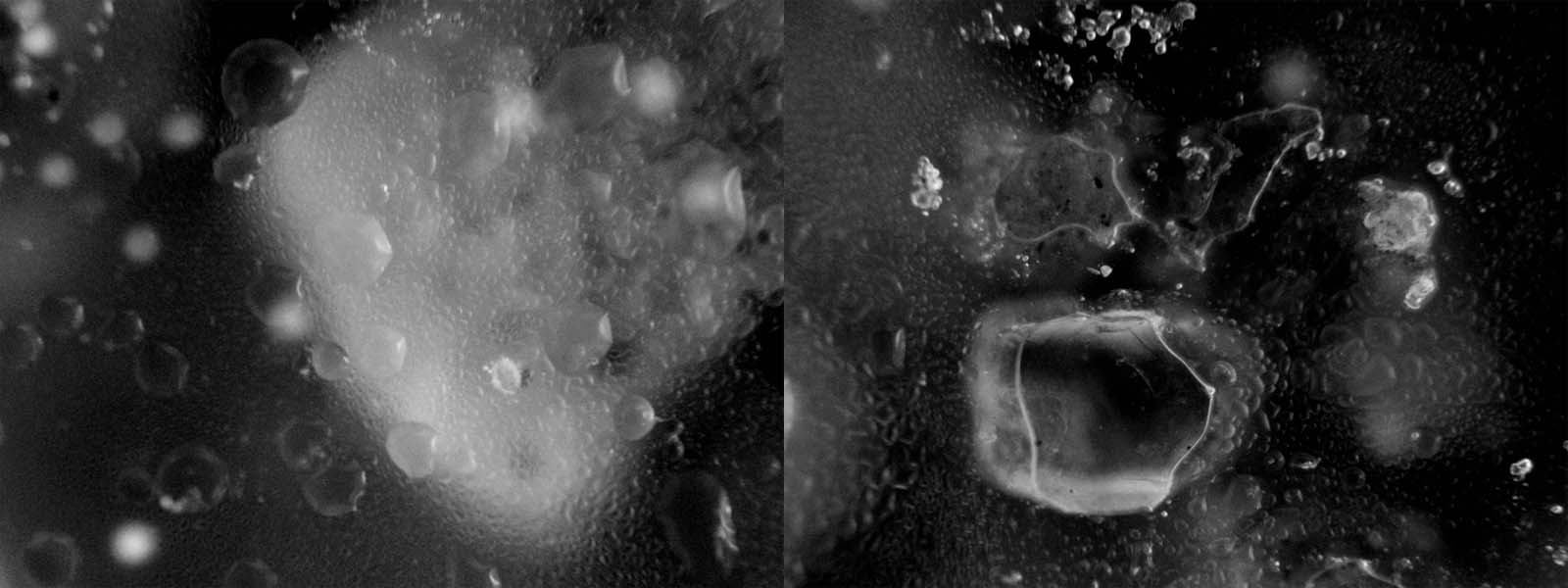
Water sample from the Confluence and entry to Gila River Wilderness
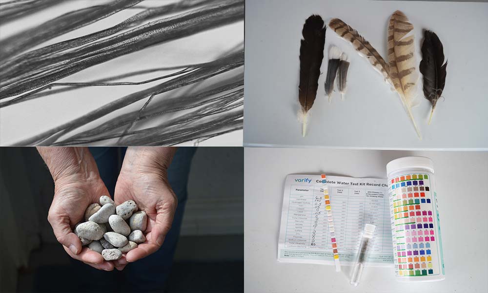
Cottonwood seed, feathers, rocks, and water quality test.
Microscopic slide of soil sample from the banks of the confluence of the West, Middle, and East Forks of Gila River