The lower Gila River has been changed over time by a series of ancient volcanoes where lava flows created a series of dams that forced the Gila River to change course. One of the most dramatic areas is the Great Bend of the Gila, where the river makes a 90 degree turn as it continues its journey southwest to meet the Colorado River. Just as the river changed its course, so have the diverse populations that have inhabited the area, near the town of Gila Bend.
Located on the western edge of the Sonoran Desert, Gila Bend has been home to
Indigenous peoples who left thousands of petroglyphs and canals throughout the area. Known as the “Crossroads of the Southwest”, the town of Gila Bend was established in the ideal geographic location to emerge as an important transportation hub, linking stage coach and rail lines connecting the mining camps and boom towns in central Arizona to a rapidly expanding national transportation network. In a place where the course is constantly changing, there is plenty of elbow room and inherent weirdness that is Around The Bend
3°13'45.8"N 112°46'09.6"W
[1] Gillespie Diversion Dam
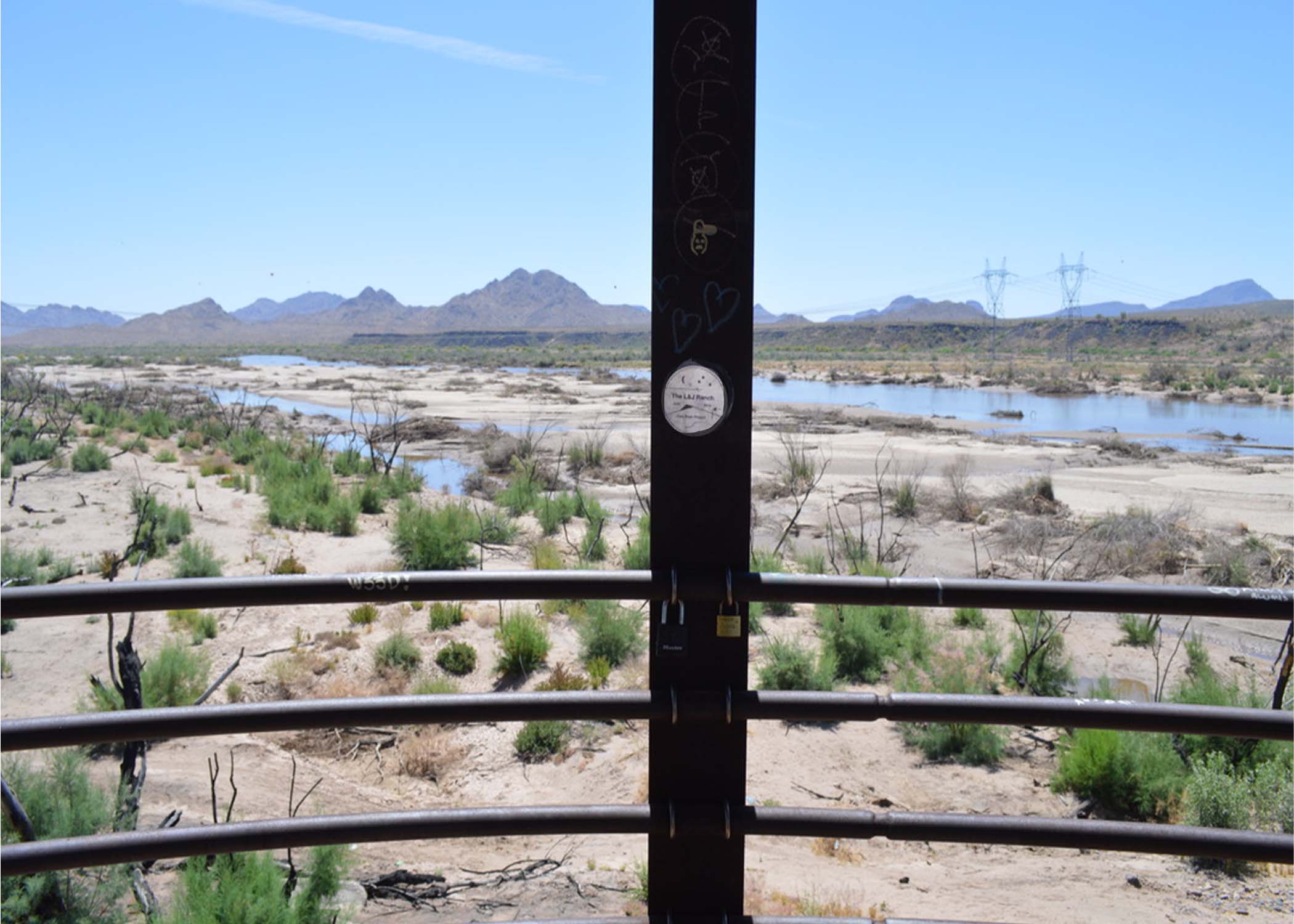
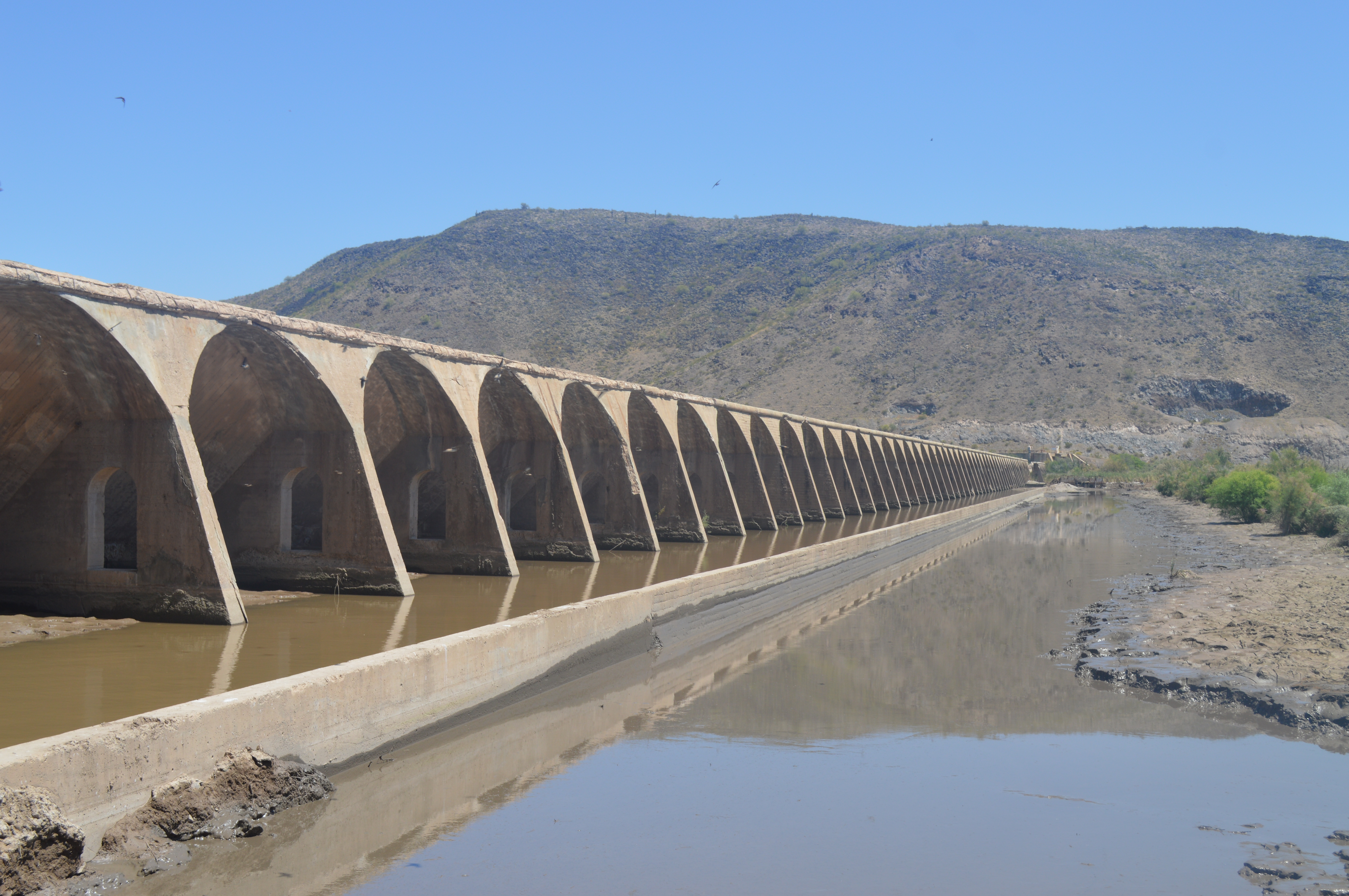
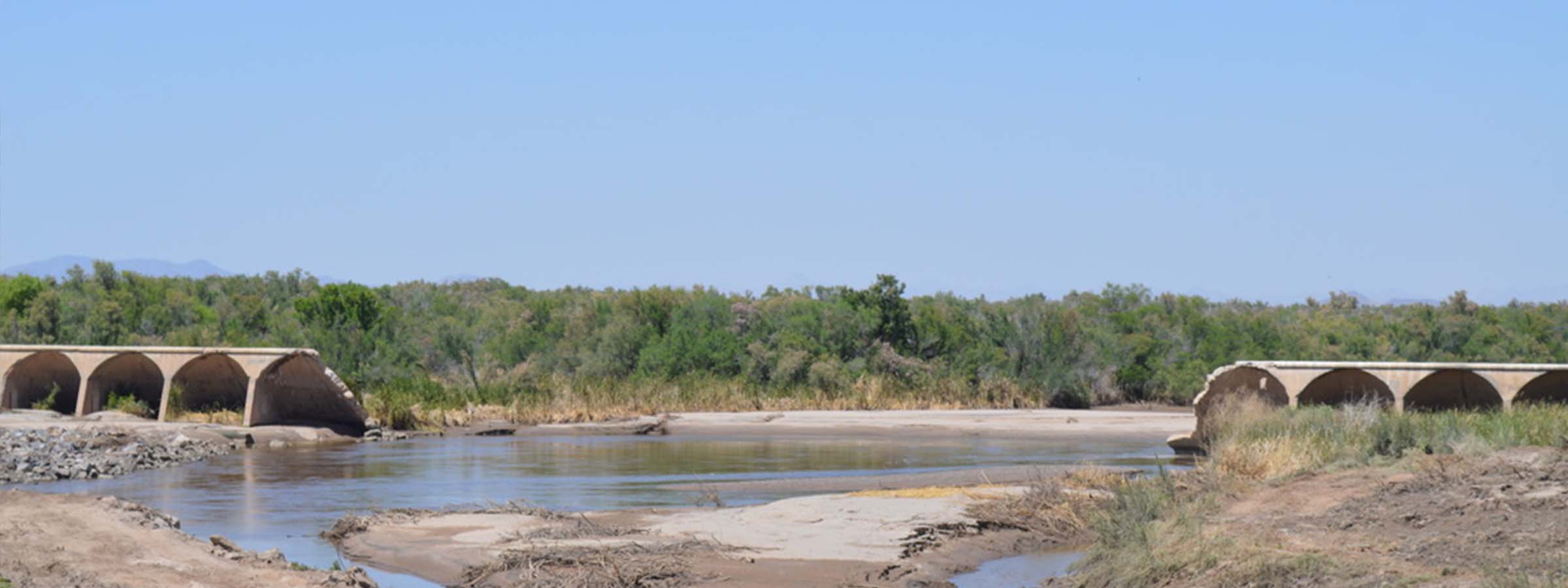
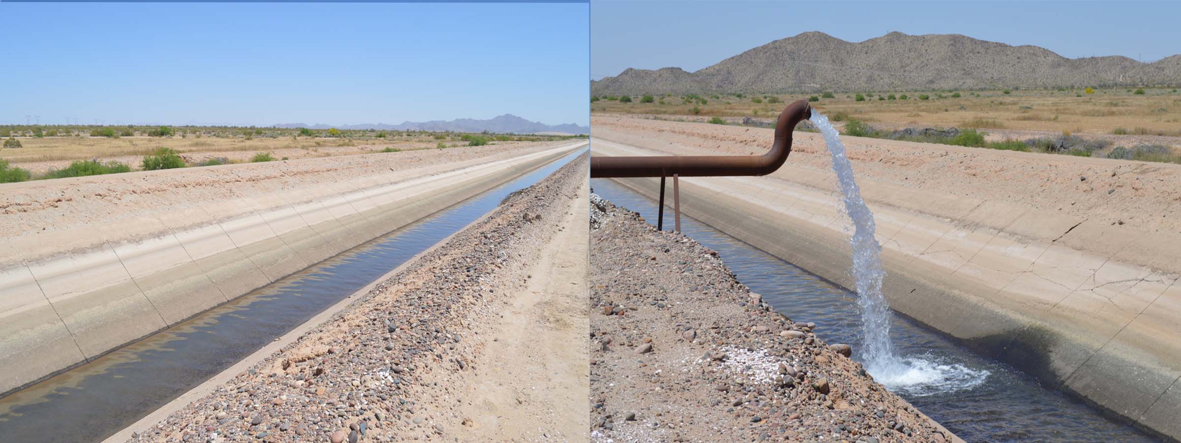
The Gillespie Dam is one of the few places it is possible to view and access the exact location where the Gila River is diverted that is not limited by surveillance camera warnings, high fences, locked gates, and no trespassing signs. Built in 1921 by a wealthy rancher, Frank Gillespie, the concrete dam brought Gila River water (42 miles by canal) to his La Paloma ranch. The dam also served as a paved route across the Gila for early Ford Model T vehicles, an early route that would later become a segment of Hwy 80, one of 4 transcontinental roads of the time. Five years later Arizona built the steel truss bridge downstream. The bridge is still intact, but severe flooding on the Gila River in 1993 broke through the concrete dam, creating a natural wetland area around the dam for fish and waterfowl. Much like many damaged structures in the southwest, it was never repaired. Rather, an earthen embankment was created that serves to divert water so it can be pumped into nearby canals that are used primarily for agriculture.
The Gillespie Dam was inspired as much for completing a segment of Highway 80 (between Phoenix and Yuma) as it was to fill irrigation canals from the Gila River for agriculture. By 1920, Arizona had struggled to find a route to construct their segment of the transcontinental highway, but the changeable desert Gila River proved to be too much for the engineers. Flooding washed out bridges to the west, toppled piers and made the ground too unstable to support a paved road north of the Gila. A southern route required the highway to cross the Gila River. Frank Gillespie, a native of Oklahoma, seized the opportunity to replace yet another failed (Peoria) dam in this location, with an immense concrete dam that would allow him to access the system of irrigation canals branching from the Enterprise Canal (later the subject of several lawsuits). Learning from the past, the Arizona Highway Department knew the Gillespie Dam would be a temporary structure, but would allow them time to get the Gillespie bridge in place, which is standing today.
Water from the Gila River is diverted to the Gila Canal just past the breach in the Gillespie dam, supplying water to the farming and ranching communities below the dam. The remaining water becomes a floodplain that extends below the steel truss bridge and spreads out depending on the water level. The landscape shows signs of high-water levels as well as fire. In April 2022, fire burned through the area, primarily fueled by dry Salt Cedar trees, that are invasive to the area and are large consumers of water.
The area around the Gillespie dam has become a popular local destination for fishing, picnics, and hiking. Currently the area is behind a fence, that is easily crossed, but the expectation is the popular day use area will be blocked by the new construction of pumps pulling water into the Gila Canal. A brief conversation with several youth who stopped to access the floodplain below the lookout, amplified the resentment for “changing the landscape to ruin a great place”.
[2] Pump Stations
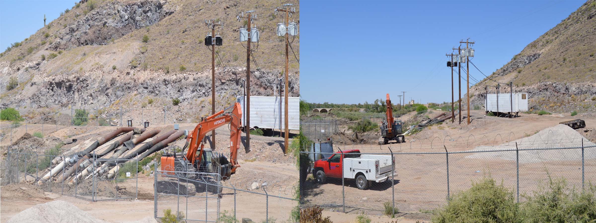
The Paloma Irrigation and Drainage District (PIDD) has had water rights on the Gila River dating back to the late 1800s and annually diverts an average of 185,000 Acre-Feet/Year for 27,000 acres. The PIDD lies in the vicinity of Gila Bend with its diversion point on the Gila River being about 25 miles south of the confluence of the Gila River and Hassayampa River. Return water flows back into Bull Durham Wash, which is tributary to the Gila River.
Currently, the Paloma Irrigation and Drainage District operates and maintains 99 miles of irrigation ditches and canals; 100% are lined with concrete. The PIDD has the right to divert essentially all the water that arrives at Gillespie Dam on the Gila River and supplements it with water pumped from wells that rely on groundwater. It is responsible for maintaining canal liner condition and operational reservoirs and has 22 agricultural users.
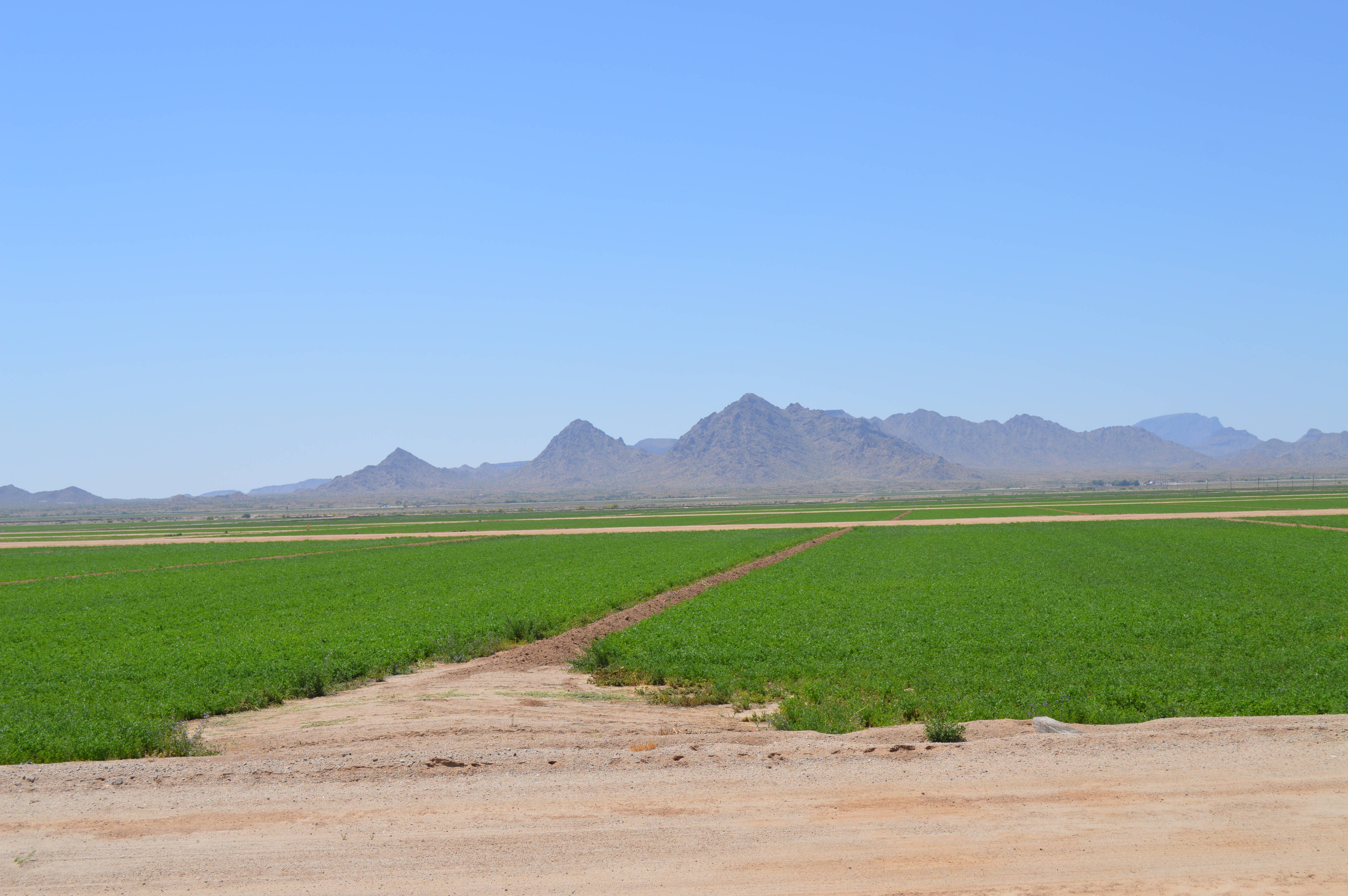
The most important crops grown in this district are alfalfa, corn, cotton, sorghum, millet, milo and other small grains. Crops can be grown year-round in this warm dry climate with little need for frost protection. Just as water conservation is important, so is the efficiency of the irrigation system to deliver water. Laser-leveling fields, shaping the furrows, lining the ditches, and using high-flow irrigation gates are methods used to improve efficiency.
-- Title -->
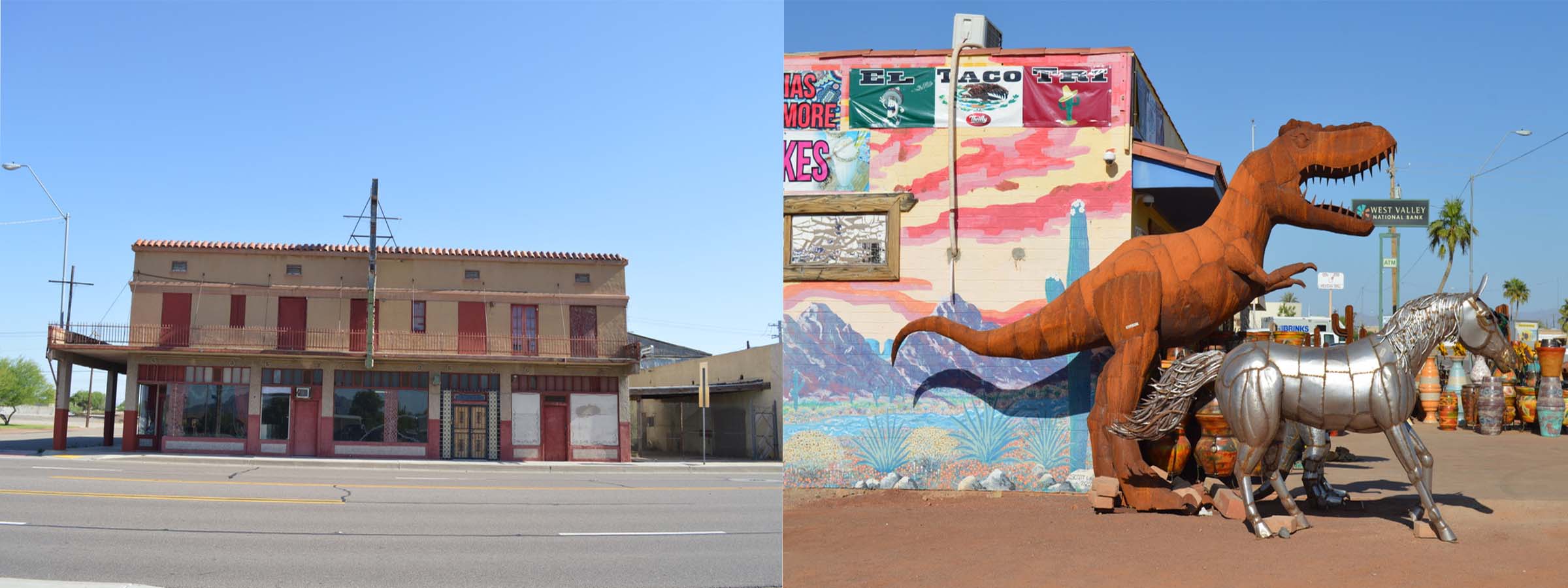
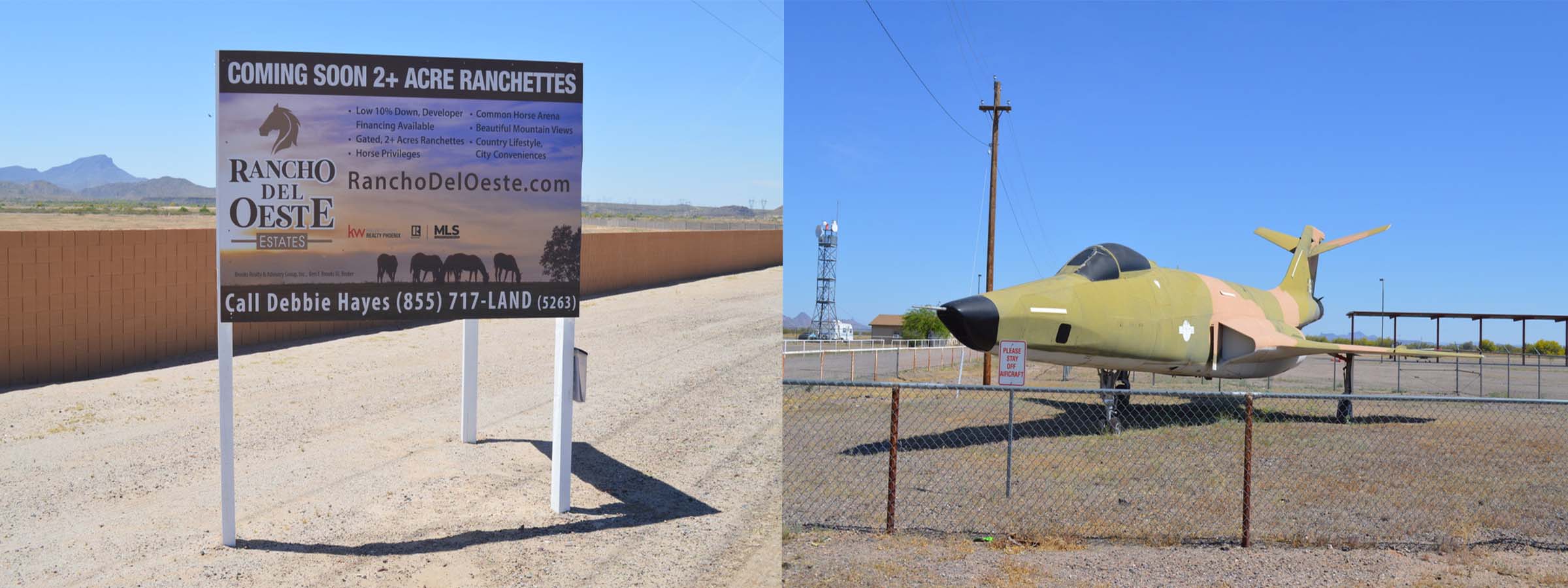
[3] Gila Bend
Gila Bend is not like Phoenix. It is not Paris either. It is the gateway to the Sonoran Desert, it is a crossroads to the west, and it is a hilariously innovative place of triumph. Named for the great bend in the Gila, it is a small rural town and continues to be a transportation hub that attracts many of its travelers to stop on their way through town. Although Gila Bend has no history of space exploration, the Space Age Hotel and Restaurant originally featured autographed photos of astronauts and space age hotel rooms. After a fire, the restaurant was rebuilt and re-opened with updated space murals and NASA shuttle-era photos. And, the ‘flying saucer’ above the hotel lobby.
Its location lies in one of the most geographically passible routes west, that has been used by Spanish missionaries, army expeditions, gold rush miners headed to California, railroads and transcontinental trails, and stagecoach routes that guided the current highways connecting California to the east. When the railroad laid its tracks in 1879, the town moved four miles southwest to its present location to take advantage of the economic opportunity. Portions of the 1879 Wagon Road and 1920's unpaved 'highway' from Yuma to Phoenix are still visible today.
Travelers in the 1920's and 1930's enjoyed rare ice-cold drinks and fresh ice cream when stopping at the Stout Hotel in Gila Bend, which had its own ice generating plant. Now the hotel is officially on the National register of Historic Places and may be home to a future hotel and museum, or possibly a Town Hall. The town is known for its roadside dinosaurs and somehow, they don’t look out of place in the Sonoran Desert. They do look a bit out of place at most gas stations though.
[4] Enterprise
After turning off Pima, the main street through Gila Bend, there are no more dinosaurs or space-ships. Two-lane roads lead to the diverse economic enterprises that are interspersed with the farms, ranches, and historical locations. Gila Bend has been setting its sights on establishing a national and international energy transmission corridor. Using cutting-edge technology, it is fast becoming known as the solar capital of the nation. It is also home to the nation's second largest natural gas power plant, a $50 million paper mill, and more recently added Calgon Carbon, a global leader in making water and air safer and cleaner to industry. Sitting at the edge of the Sonoran Desert, it seems there will be plenty of space for new enterprise to take advantage of.
The unemployment rate in Gila Bend is 1.5% (down from 6% in 2019). Anticipated growth is demonstrated by more than a $28 million investment in infrastructure, a new Resource Center, and re-surfacing the runway at the Gila Bend Municipal Airport, with its entry flanked by two McDonnell Voodoo (RF101C) jets on display. New homes are being built in a gated community, and even the Sonoran Desert RV Park, with most of its 628 sites empty, is planning further expansion. Stay tuned, as Gila Bend enters the next phase in its role as a crossroad.
[5] Samples
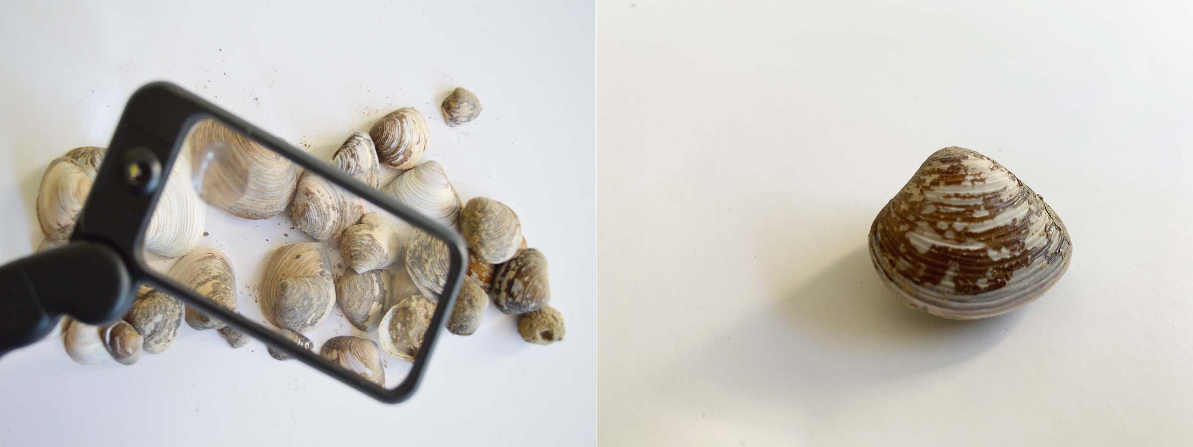
It was impossible to traverse the flood plain, so we opted, at some personal risk, to achieve a sample from the Gila Canel just south of Gillespie Dam
To our surpirse, the terrain along the Gila Canal presented a massive amount of small clamshells. .
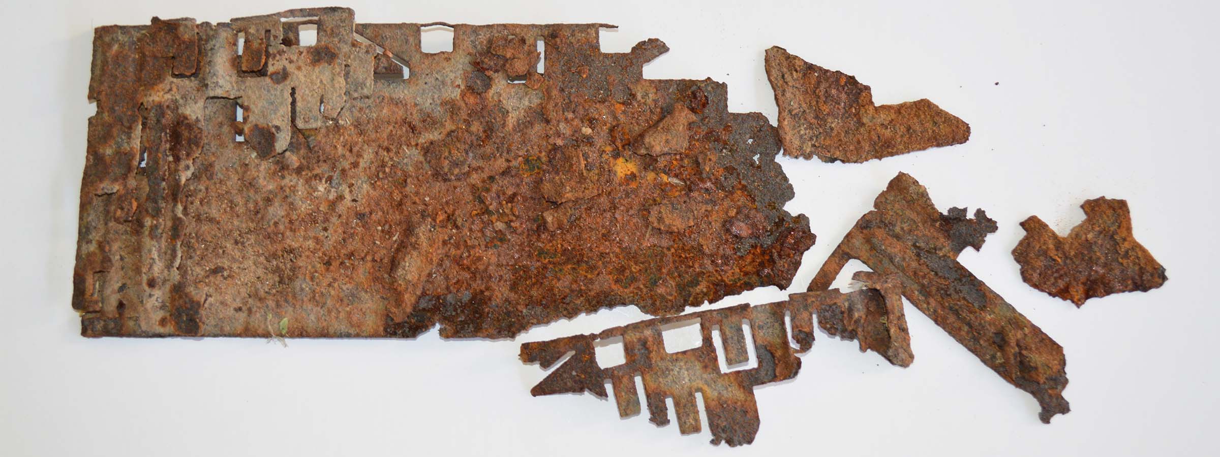
The The desert is a harsh enviornment for any mechanical systems over time as is evidenced in ththis remnant from the first irrigation pump south of Gillespie Diversion Dam.
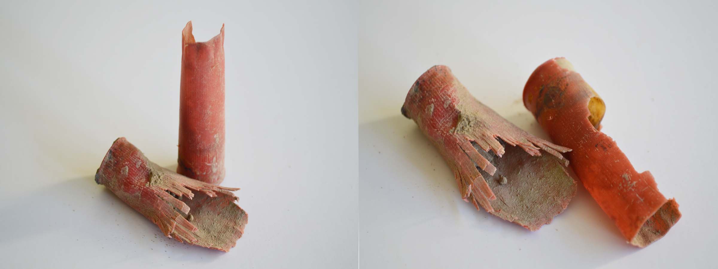
Shotgun shells. Most likely from duck hunters.
Warning regarding venomous snakes at our camp on the edge of the Sonoran Desert.