Borders look easy to cross, a simple sign welcoming you to a different state. But the reality is that a border crossing represents a change of jurisdiction complete with new governance and policy over land use, a different culture of people, new values and economic needs. The river only travels in its destined path, but the roads must connect towns with different resources and traditions. To follow the road is straight forward, but to follow the river may necessitate a form of trespass. The rules of ownership, access and privilege can be concealed. The current politics of Arizona not-withstanding, there is, in crossing this border through which the Gila River passes, a perception that water is first and foremost a commodity.
>
32°43'32.4"N 109°06'07.0"W
[1] Duncan
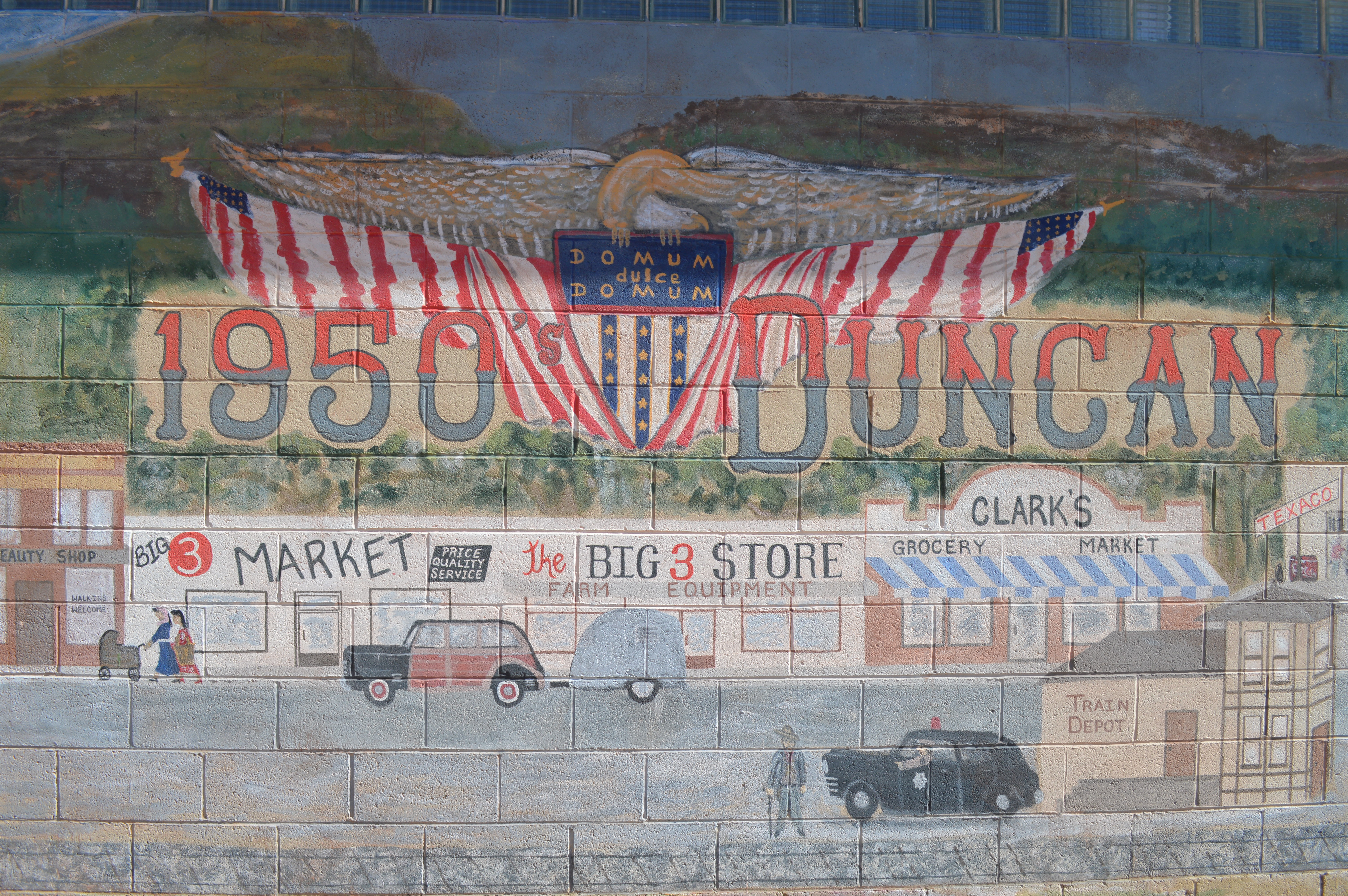
Four miles from the border of New Mexico is the small rural town of Duncan (population 800). Duncan is the first town in Arizona through which the Gila River flows. The town is in the Mid Elevation Climate Zone that includes high deserts, semi-desert grassland, chaparral, and woodlands ranging from 3,500 to 5,000 feet. Annual precipitation ranges from 10 to 20 inches. Founded in 1883, Duncan emerged as a marketing and shipping point for copper and zinc from nearby mines to mid-west and eastern markets. The railroad-stop in Duncan also made the town a marketing center for farm produce and a shipping point for ore and cattle. The area has a rich history of indigenous habitation inclusive of pre-historic cultures. Duncan is both a quaint hometown with restored buildings and a stressed community fighting a poor economy, indicative of a struggling community trying sustain its identity and relevancy in the rural Southwest.
Title -->
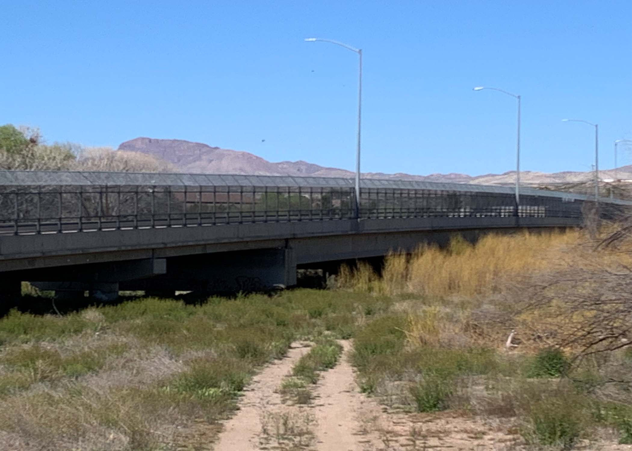
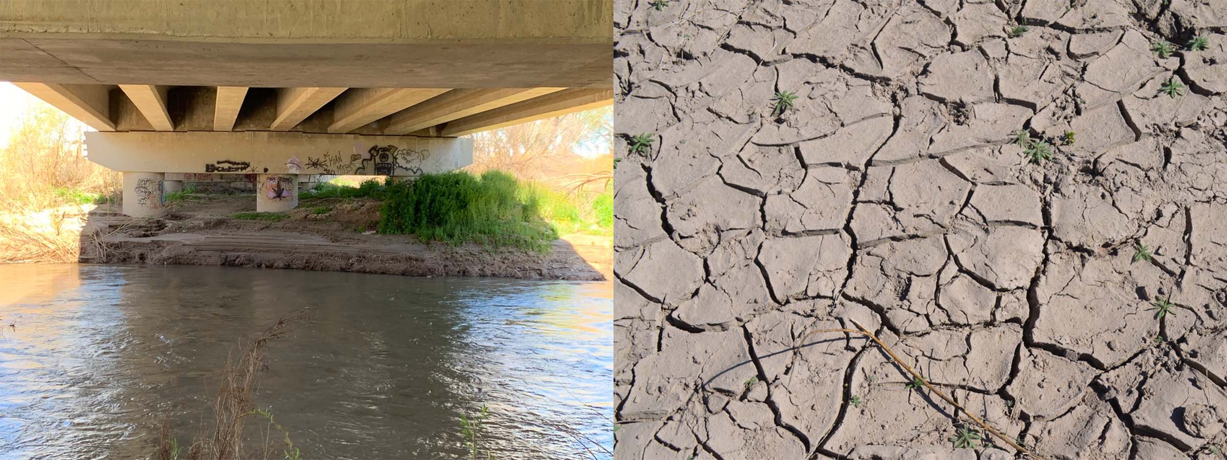
The single bridge across the Gila River at Duncan connects Main Street (US 75) and “the Old West Highway” (US 70) is not much to look at. The bridge is of modern design and non-descript in appearance. The crossing functions as an entry or exit into the town connecting Duncan with Safford to the East, Lordsburg to the West and Clifton to the North. A hiking trail provides access to the river below the bridge and features a bird and wildlife viewing area.
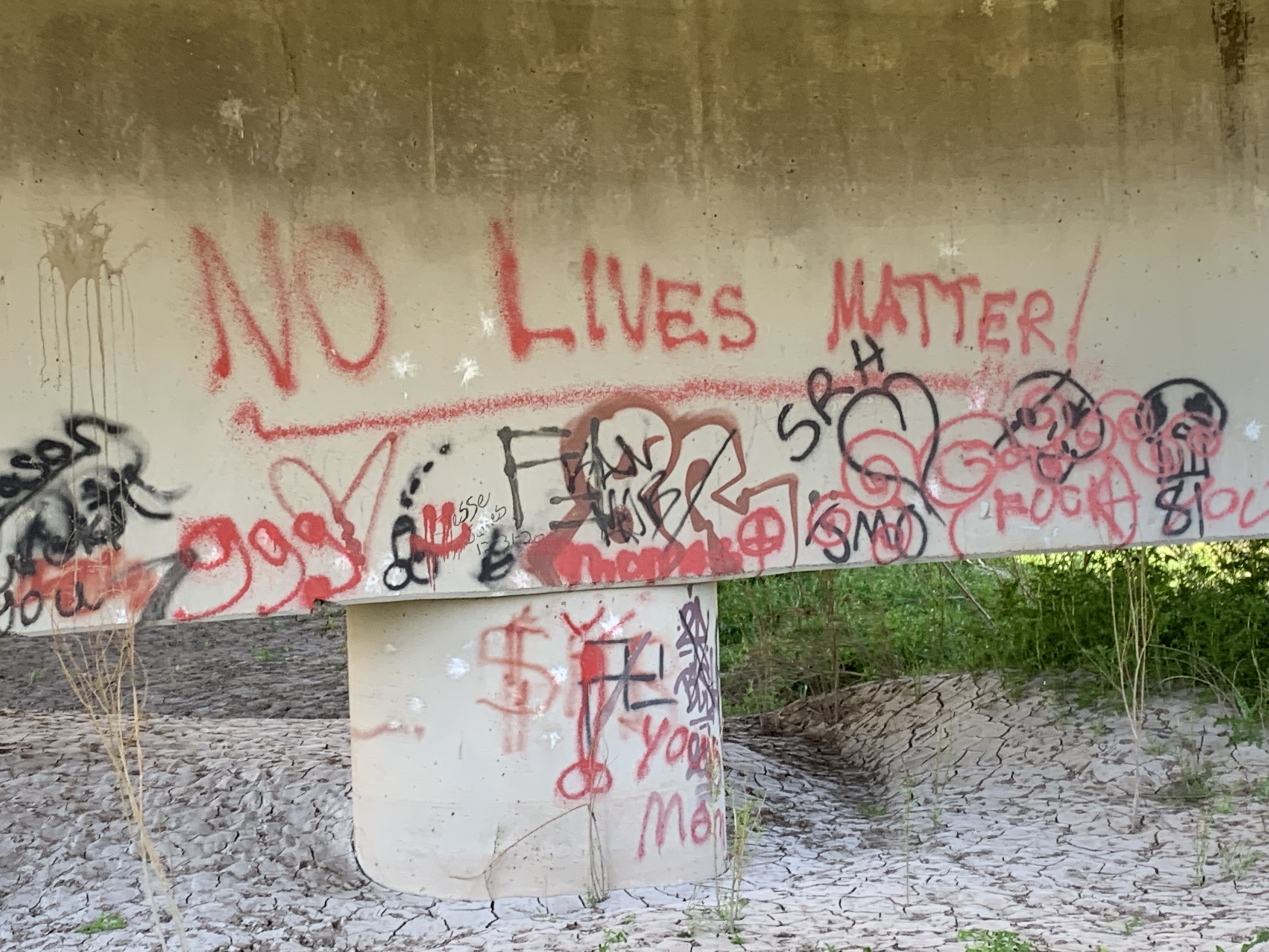
Somewhat unexpected in this rural setting, is the understructure of the bridge, littered with trash, furniture, and a repository for graffiti. This quiet and contemplative space is complicated by the expressions of frustration and distrust of others, something we have not seen along the Gila River to date. Never-the-less it is a privilege to experience the solitude of the river as it introduces itself to Arizona.
In 1881 and 1882, the Arizona Copper Company was formed at Clifton-Morenci some 30 miles to the North. Scottish investment in the mining operations served to establish a narrow-gauge railway connecting Clifton to Duncan and onto Lordsburg, New Mexico, to connect with the Southern Pacific line. This early railway provided an important infrastructure for what is now one of the largest copper mines in North America, owned by Freeport McMoRan. Geography is not the only landscape through which the Gila flows, the economics, policies, and cultural fabric of the region have a deep influence on the rivers’ trajectory. The obvious intersect with ranching and farming is part of the complex ecology of the border.
[2] The Flood of 2022
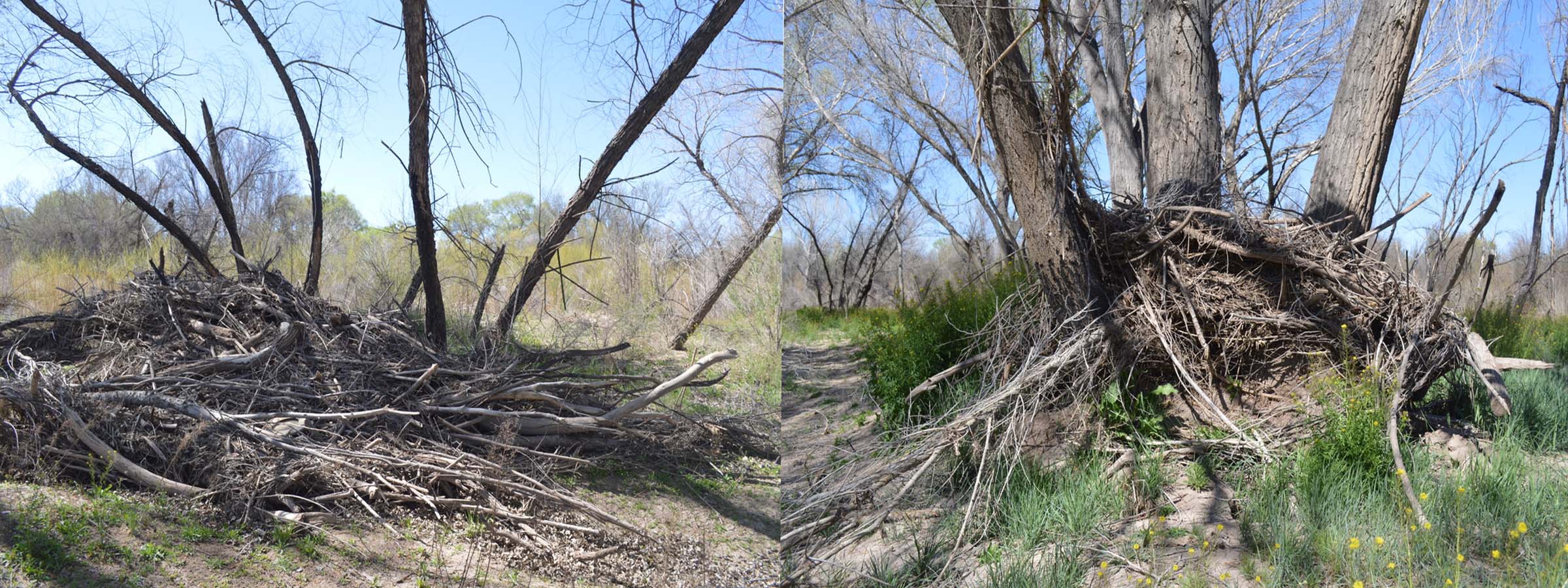
Greenlee County’s Hazard Mitigation Plan, published in 2021, identifies the Duncan area as highly likely to experience a catastrophic levee failure. Such was the case in 2022 when the Gila River crested at over 30 feet, breaking an all-time record, to overwhelm this small rural town. Duncan is no stranger to flooding resulting from levee breaks. Floods in 1978, 1993 and 2005 were also the result of levee breaches which have been directly attributed to the degradation that results from severe cycles of drought leading to conditions for dramatic erosion during monsoonal rains.
Becki Canaday, a resident of Duncan, and her son shared these videos of their personal experience during the 2022 flood.
Accumulated debris from flooding directly west of the Duncan Bridge.
[3] Three Way
Some places are just strange.
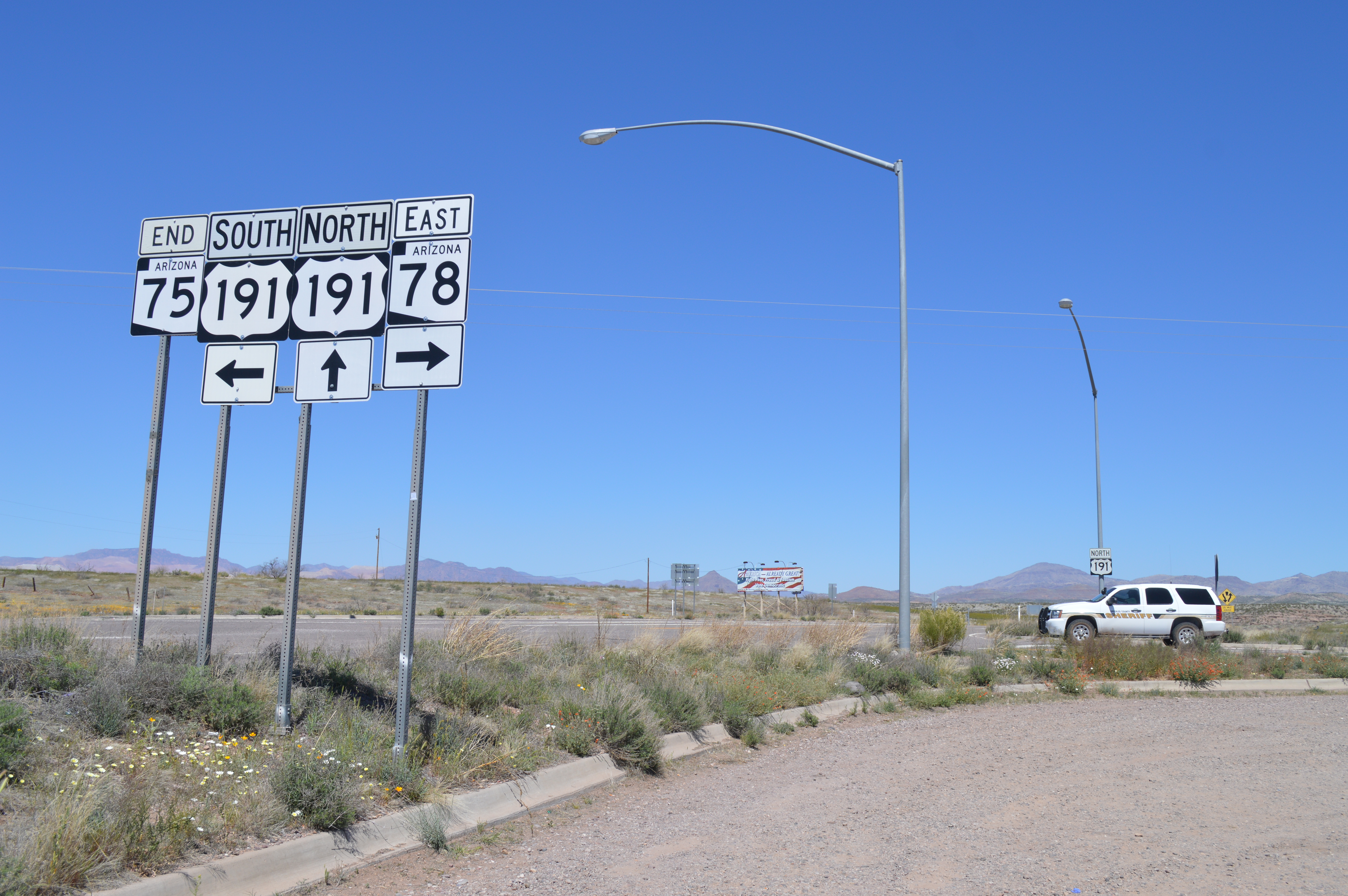
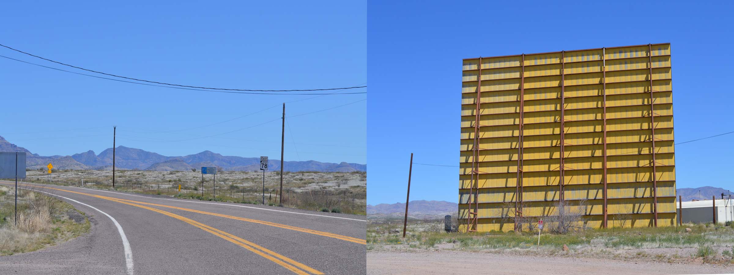
Three Way is an intersection where Highways 75, 78 and 191 meet about ¼ mile from the Gila River as it flows towards Safford, Arizona. It is distinguished by the presence of an abandoned drive-in movie theater that stands alone as a monolith rising from the high desert terrain signifying you are in 3 Way and nowhere else.
The 3 Way Drive-In was opened prior to 1955 when it was operated by C.E. Davis & Earle J. Johnson. In late 1955 it was taken over by Western Amusement. All of the ramps, the marquee, the screen and the concession stand are still standing. Operating as a kind of traffic hub, one can only imagine the draw of this place to nearby Duncan, Safford, and Clifton. Traveling through 3 Way, one would never know the Gila River is but a stones’ throw away.
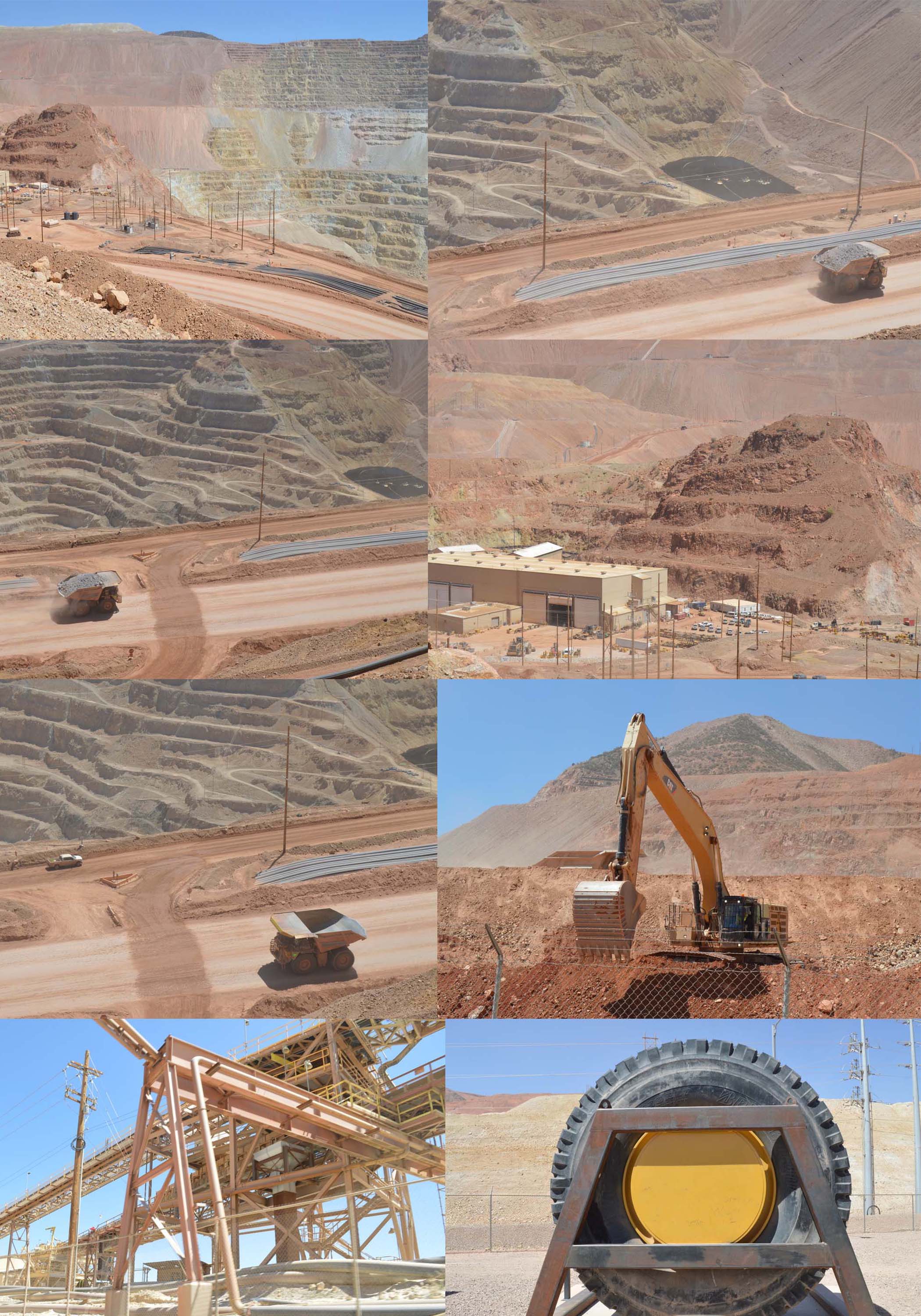
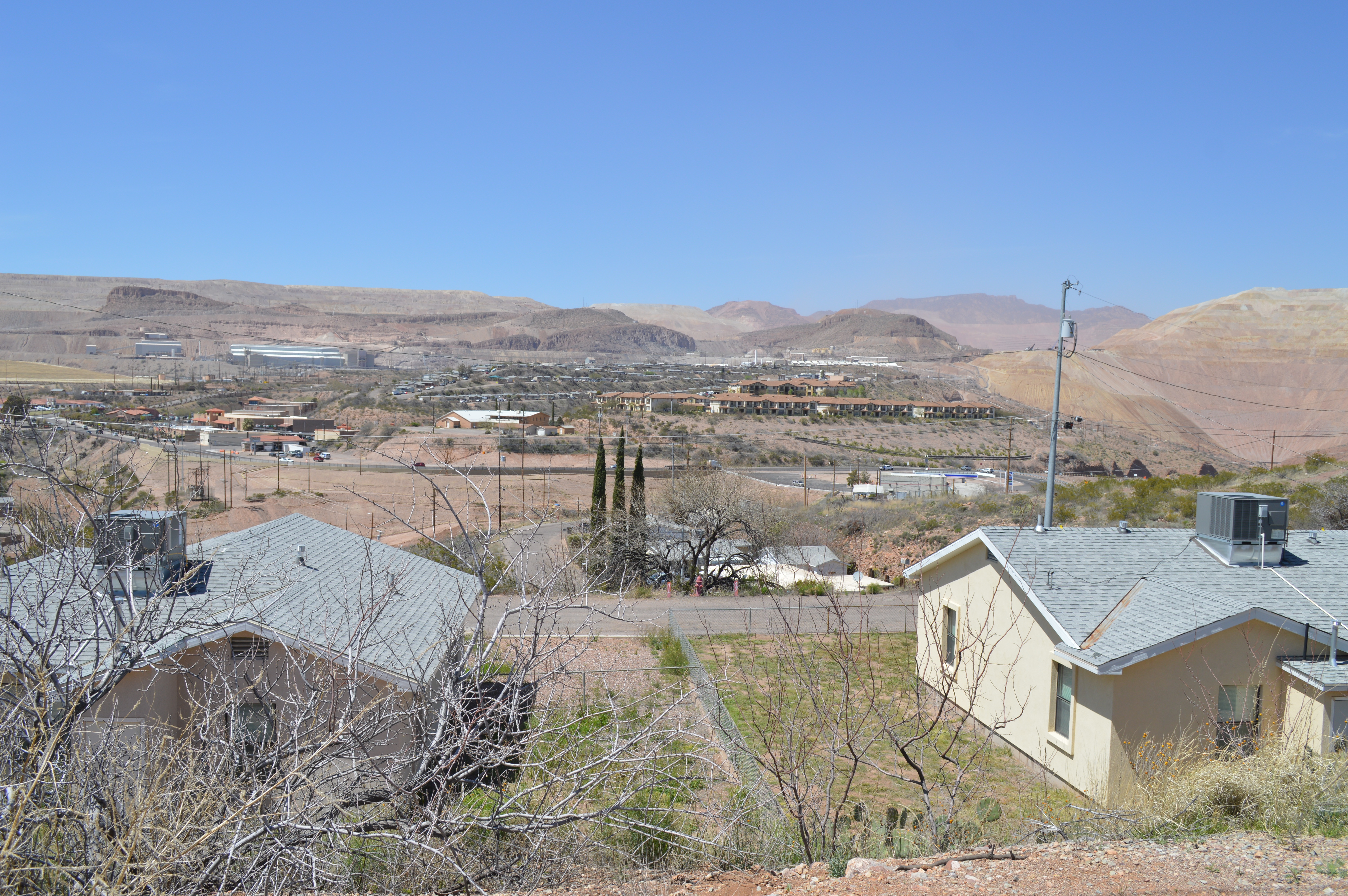
[4] Clifton-Morenci
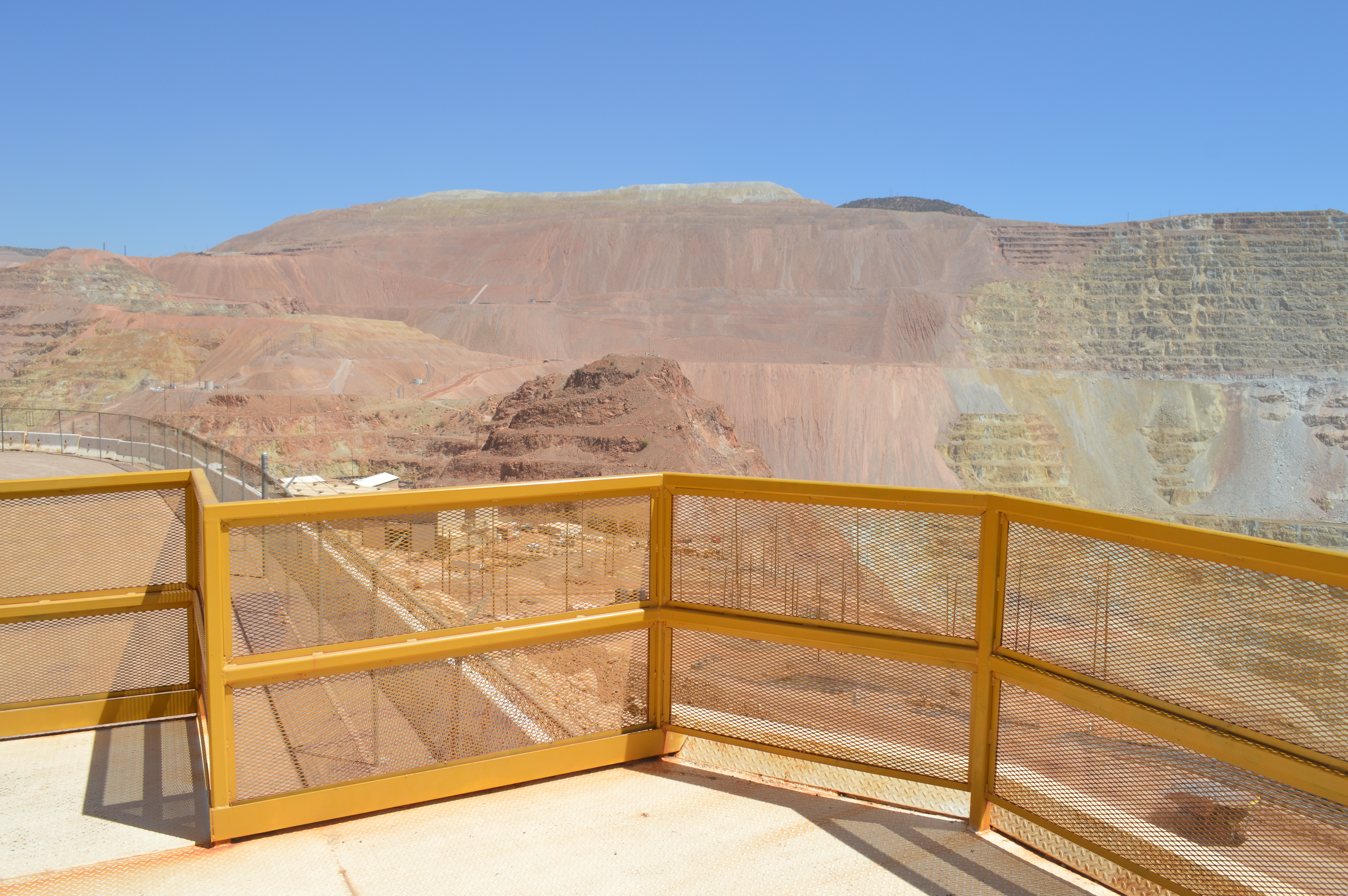
Standing on the look-out deck over the Morenci copper mine is breath-taking in scope and a spectacle of engineering. Owned by US based Freeport-McMoRan, the open-pit copper mine is the largest in the US, spans 61,000 acres, is 1000 feet deep in some areas, and produces between 700 and 850 million pounds of copper each year. The company operates a railroad that is used to ship copper concentrate out and chemicals (primarily sulfuric acid) in.
The amount of water needed to produce copper is difficult to comprehend and is only offset by the companies’ water recovery and control system to recycle the water. The water supply for the Morenci mine was a spectacular re-plumbing of Arizona’s water resources that was executed over decades, initially with Phelps-Dodge (later merged with Freeport McMoRan). By building the Horseshoe, ShoLow and Blue Ridge dams, Phelps Dodge provided AZ with new lakes, public fishing, recreation boating and camping. In exchange, they got credits for 250,000 acre-feet of water from the Black Creek (40 miles from Morenci) where it was lifted 700 feet to rim of Black Canyon, then traveled 6.5 miles in underground pipes to a pump station in Morenci. These agreements involved 6 different counties, as far away as 180 miles from Morenci, required negotiation with 13 different federal, state, and local agencies.
The Morenci mine employs a conventional open-pit, truck and shovel operation. The operation includes drilling, blasting, loading, and hauling. The mine fleet includes 154 trucks, 14 blast hole drills, 13 electric rope shovels, and five front-end loaders. The operations are supported by ancillary equipment such as track dozers, motor graders, wheel loaders, backhoes, and water trucks. The size of the equipment needed to haul the tons and tons of ore is gigantic.
Freeport McMoRan OWNS the town of Morenci. The town is a business plaza, health care complex, has recreational facilities, and a school district, in the form of a strip mall. Locally referred to as “Freeport”, the company employs approximately 1700 employees, which changes along with the price of copper. They provide housing to their employees for a low deposit and rent ranging from $200/month for a 1-bedroom apartment to $500/month for a 4-bedroom home. Rent and trash are deducted from the employee’s payroll. The wait list for a place is currently 918.
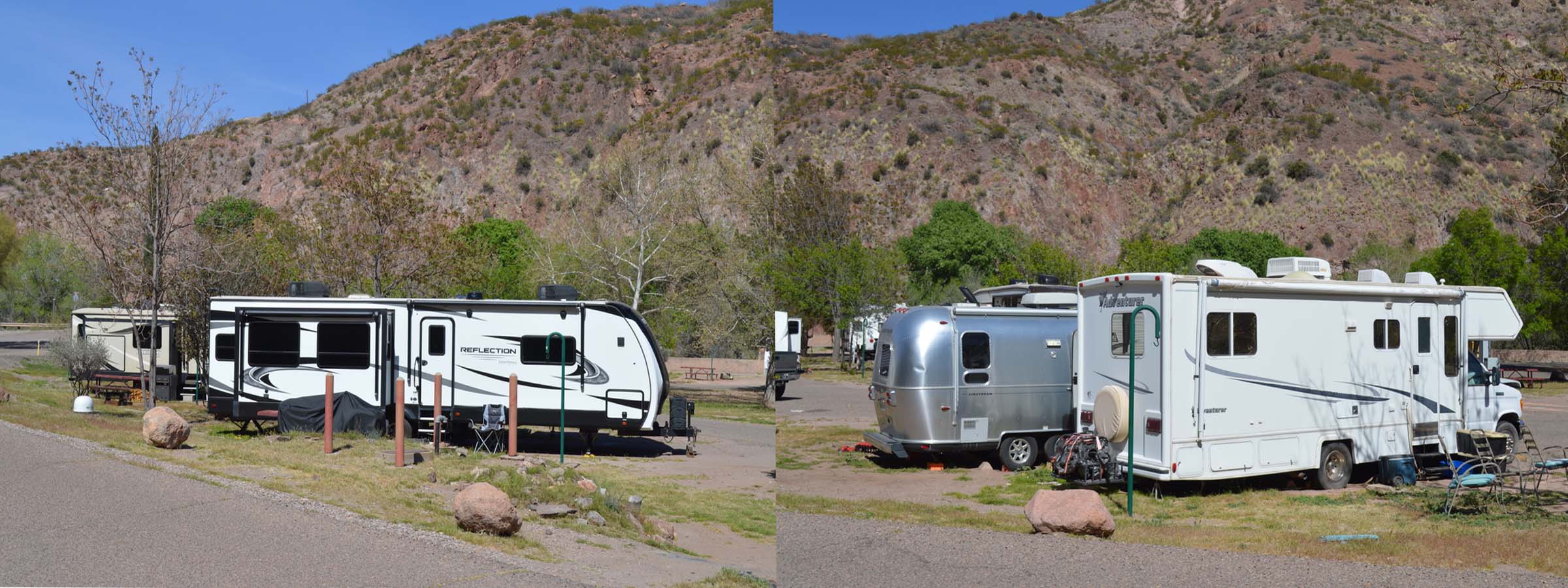
Local RV parks are filled with Morenci mine workers as housing is not easily available in any of the small neighboring towns. The L&J Ranch mobile lab (Airstream) squeezed in to a park in Clifton AZ, only 4 miles from Morenci. The park was run by inmates bussed in from a prison in nearby Safford on a daily basis. The town of Clifton was home to many of the Morenci miners under the ownership of Phelps Dodge. Our neighbor was a single mom, a crane operator at the mine, and #350 on the wait list.
Clifton, AZ. is a mining town on the San Francisco River. The town has survived many economic challenges that parallel the copper mining industry. Not the least of which was a 3-year strike that necessitated the National Guard, resulting in the largest decertification of Unions in US history. In 1879, Arizona Territory’s first steam powered locomotive was built to take ore from the mine to the smelter, built on baby gauge (20 inch) track. The people of Clifton also persevered after severe flooding on two occasions. Today Clifton has about 3300 residents, attracts tourists to the beautiful landscape, celebrates its rich history, and continues to mine copper.
[5] Samples
,br>
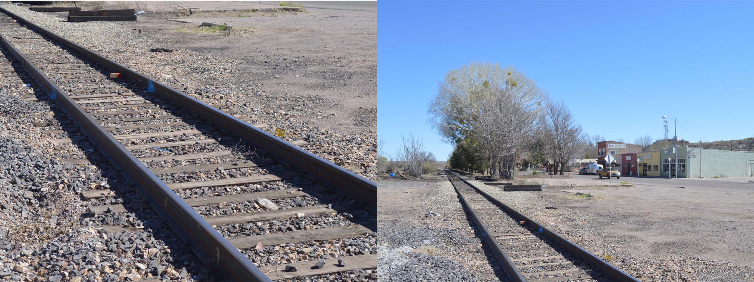
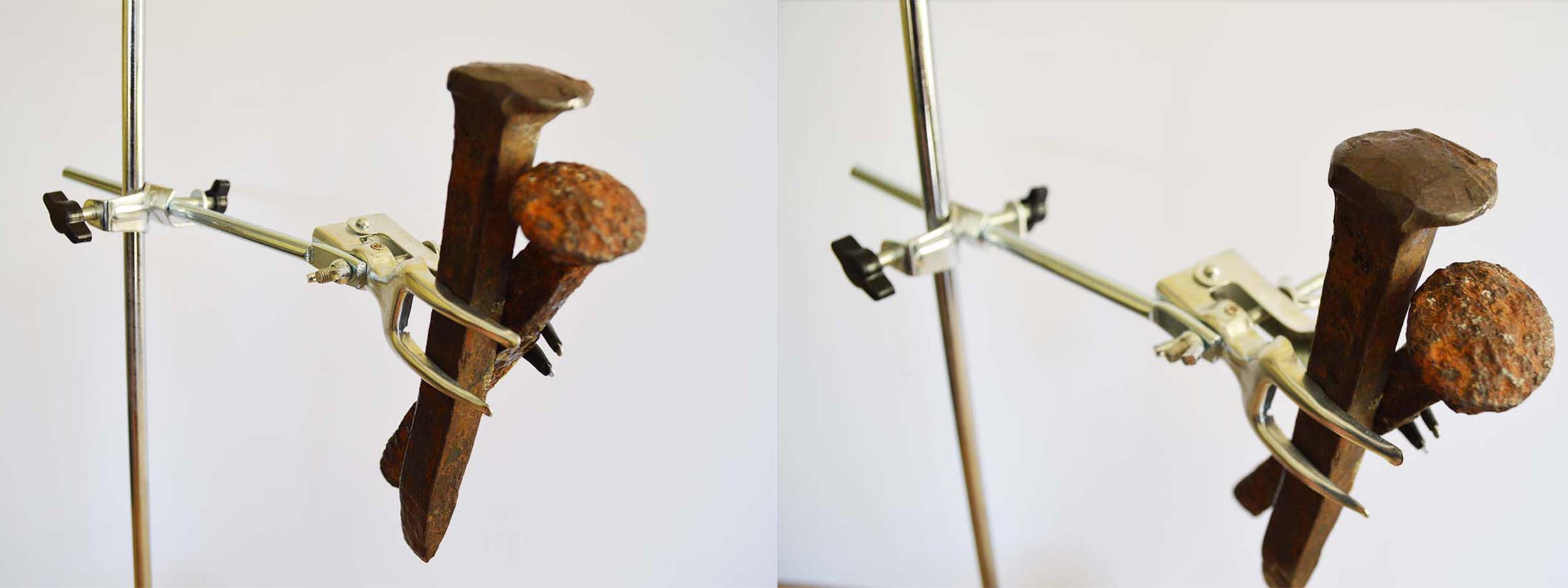
The Railway spikes from the Arizona Eastern Railway (AZER) crossing is at the intersection of well-traveled State Route 78 and U.S. Highway 70 located on South side of the Gila River and Duncan city center.
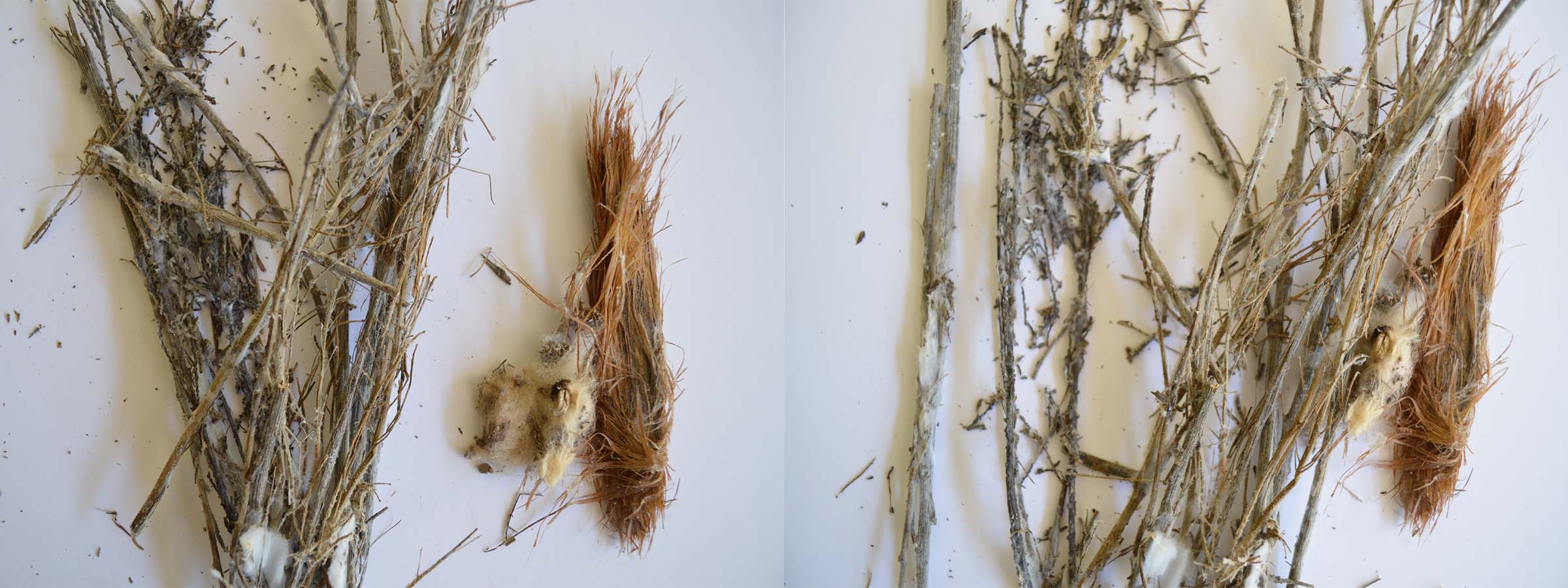
Selection of plant material from under the highway overpass where State Route 78 meets U.S. Highway 70. This location was entirely submerged during the flood of 2022.
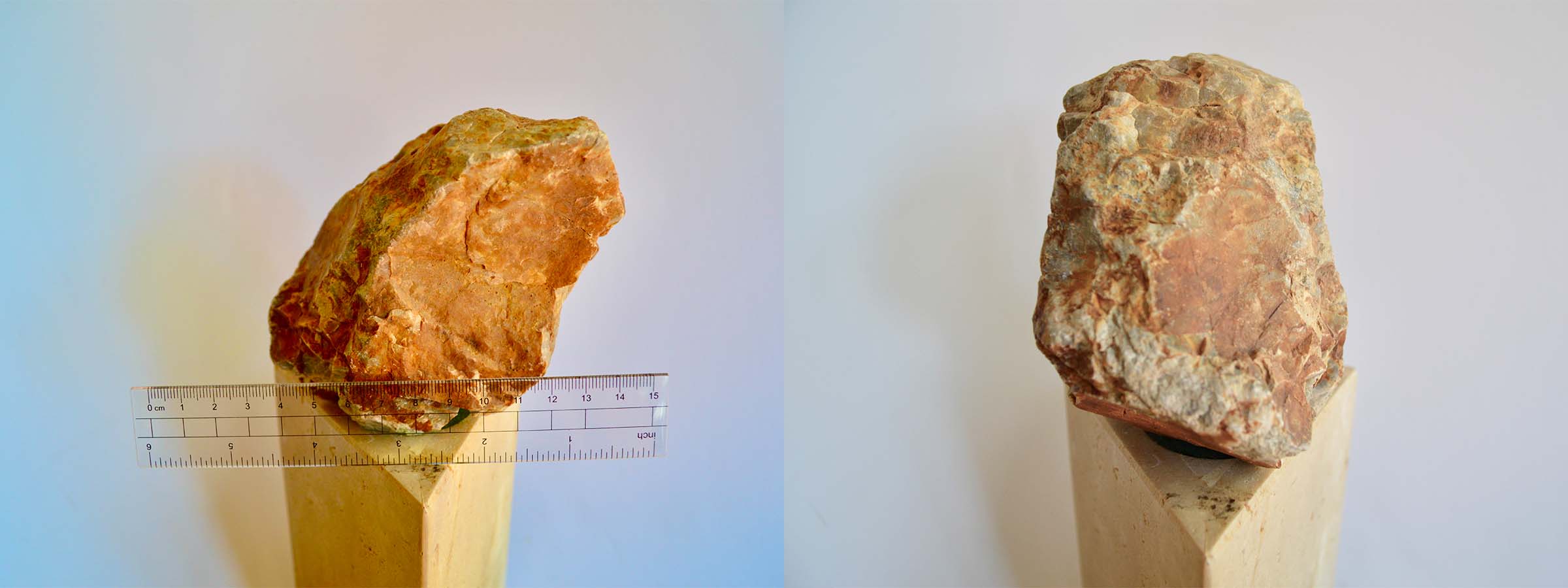
Rock types in the Morenci district ranging from Early Proterozoic schist and granite through Paleozoic and Cretaceous sedimentary sequences are overlain and intruded by early to middle Tertiary igneous rocks.
Water sample from Gila River in Duncan, Arizona.
Flood stage at this location ranges from a gauge height of 20 ft to over 22 ft for major flooding events.
 >
>
 ,br>
,br>